

Field Spraying, Spreading & Mapping
Whether you're managing crops, improving pastures, planning forestry operations, or overseeing high-value assets like vineyards, mines, or golf courses — our mapping provides the detail and confidence you need. But it doesn’t stop there.
With our precision spraying and spreading services, we help you take action on that data — applying product exactly where it's needed, when it's needed, with minimal waste and maximum efficiency — regardless of ground conditions.
Plan smarter. Apply precisely. Maximize your land’s potential — from the map to the paddock, no matter the terrain.
Weed and Pest Plant Control
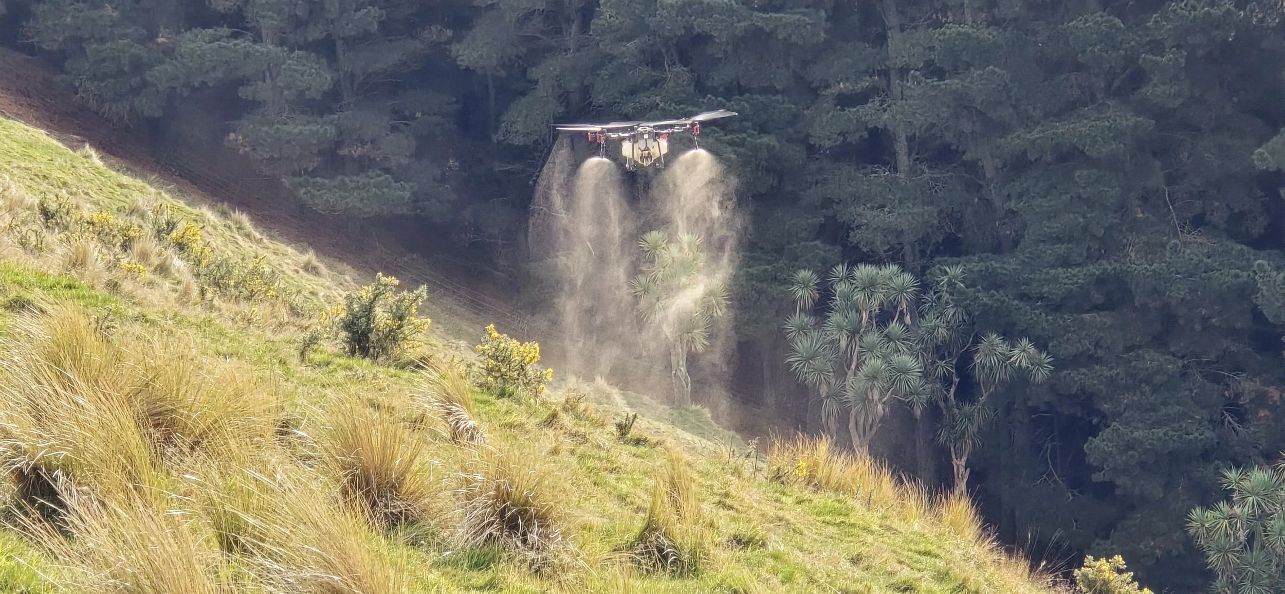
We provide precise and effective solutions for managing invasive weeds and pest plants. Using advanced drone technology and proven control methods, we help protect valuable land, infrastructure, and ecosystems while ensuring compliance with best practice standards.
Precision Spreading
Zero crop damage, Zero soil damage and Low emissions
Obstacles in the field?, Don’t worry our drones will safely autonomously go around or over them.
Grounds to wet for traditional methods? We can work in any conditions without leaving any mess

Spreading Applications:
Fertilizer’s
Seeds - Broadcast hills to cover crops
Slug baits
Board Acre or Targeted Applications
We can generate NDVI and other vegetation indices maps, capturing differences in crop performance allowing us to generating prescription maps that allow agricultural growers and operators to make timely and formed treatment of their crops giving the potential to improve crop quality, maximize yield rates and reducing risks such as crop lodging.

Advanced Data Analytics
Combined with our multi-spectral mapping, our advanced data analytics provide you with easy-to-understand crop data. This information is crucial for making informed decisions about fertilization management, ultimately leading to healthier crops and higher yields.
Precision Spraying
Zero crop damage, Zero soil damage and Low emissions
Obstacles in the field?, Don’t worry our drones will safely autonomously go around or over them.
Grounds to wet for traditional methods? We can work in any conditions without leaving any mess

Versatile Drone Applications
From broad-acre fields to trial plot applications and target/spot spraying, our drones can handle it all. Whether on flat terrain or hill country, our technology ensures precision and efficiency in every task.
Spraying Applications:
Pesticide
Fungicide
Herbicide
Liquid N
Liquid Fertiliser’s
Broad-Acre Applications
Our drones are designed to cover extensive fields quickly and accurately. This capability is ideal for large-scale agriculture where time and efficiency are critical. With our advanced mapping and data analytics, you can make informed decisions to help maximize yield and minimize waste.
Night Spraying for Enhanced Pest Control
During the warmer months, over 80% of unwanted insects emerge at night to forage. Our fully autonomous drones take advantage of this by safely and efficiently spraying your fields during these hours, ensuring a higher success rate in targeting pests.
Trial Applications
For research and development purposes, our drones provide precise data collection and analysis on smaller trial plots. This helps in experimenting with different crop varieties, fertilizers, and spray quantity methods, ensuring optimal results before scaling up.
Target/Spot Spraying
Our drones excel in targeted applications, allowing for precise spot spraying of pesticides, herbicides, and fertilizers. This not only reduces chemical use but also minimizes environmental impact. Our technology ensures that only the necessary areas are treated, protecting the surrounding crops and soil health.
Adaptable to Any Terrain
Whether you’ve got flat plains or challenging hill country, our drones are built to adapt. Their advanced navigation systems and stability controls allow for accurate operations even on uneven terrain. This versatility ensures that you get the most out of your investment, regardless of the landscape.
Advanced Data Analytics
Combined with our multi-spectral mapping, our advanced data analytics provide you with easy-to-understand crop data. This information is crucial for making informed decisions about spraying, pest and disease management, ultimately leading to healthier crops and higher yields.
Potential Yield Gains from Drone Applications
Tram lines in some crops, particularly high-value crops can result in a slight decrease in harvestable or utilizable yield, serving as a traditional sacrifice to save the larger majority of the field.
By using our drones, this loss can be mitigated, with the potential of offsetting the higher application costs with significant gains in yield and efficiency
See how using fodder beet in our calculator as a example had a loss of $515/ha and a potential gain of $294.57/ha after changing to drones

Keep any eye on this space, We’ll release a public calculator soon, alternatively send in your cop details and we’ll send you back a potential result.
Rig tire width
Boom width
Number of sprays/ ferts after emergence
Operation or Contracting cost ($/ha)
Expected yield / ha
Budgeted sale ($/kgDm or $/T)
Area planted (ha’s)
Advanced Crop Management and Analysis
Effective crop management and productivity start with understanding your plant and soil health. That’s why we utilize multi-spectral mapping with drones, enabling us to see beyond the naked eye in high-value agriculture, horticulture and viticulture crops as well as forestry and golf fields.
Combined with advanced data analytics, we provide our clients with valuable, easy-to-understand plant and field data.
Great for:
Arable Crop Monitoring
Plant Count and Survival - i.e. Grape Vines
High Value Crops
Reducing Crop Lodging Risk
Identifying Soil Compaction or Poor Performing Area’s


Multispectral imagery can allow us to detect early risks such as diseases and pest infestations though plant health and performance analysis which isn’t yet visible to the human eye allowing for early intervention and prevention.
We can supply these services as individual on a job package.
If your company or fields could benefit then please don’t hesitate to discuss the best option for your operation!